9 Best Photo Spots of Charles Bridge, Prague, Czech Republic

- View (7,189)
9 Best Photo Spots of Charles Bridge, Prague, Czech Republic

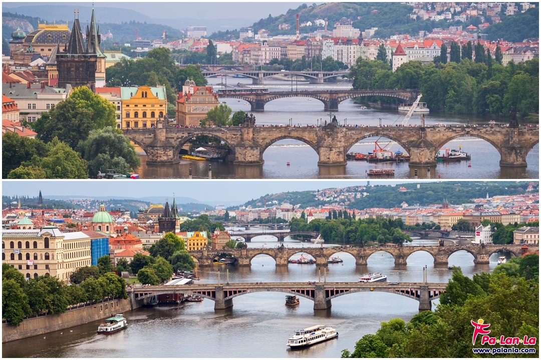
Charles Bridge is the landmark of the old town that has long been used as a route to travel between east and west sides of the city for over a century. It was promoted as one of the most valuable and beautiful buildings in the Czech Republic. Because of the architecture, sculpture and location that oversees the old town, the Charles Bridge offers picturesque views for everyone to enjoy and take photo.
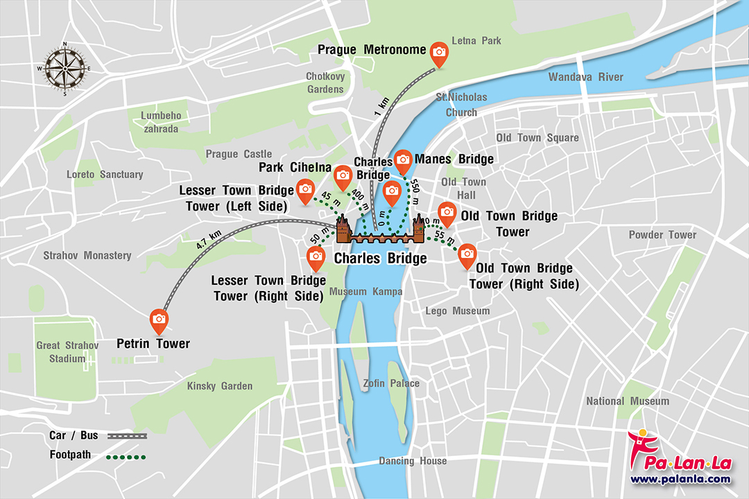
Location map, 9 beautiful angles, photographing the Charles Bridge
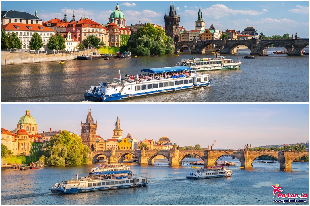
1. Charles Bridge
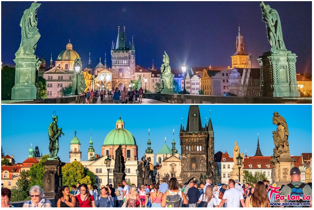
Charles Bridge, one of the main place that tourists always come to press the shutter of their camera. It is a famous place for take pictures at the middle of the bridge over the river which always see the hordes of tourists with their cameras around the bridge. Because this area offers breathtaking views that could get outstanding pictures of the bridge over the entire to the old town bridge tower
GPS Coordinates : 50°05'11.4"N 14°24'41.2"E
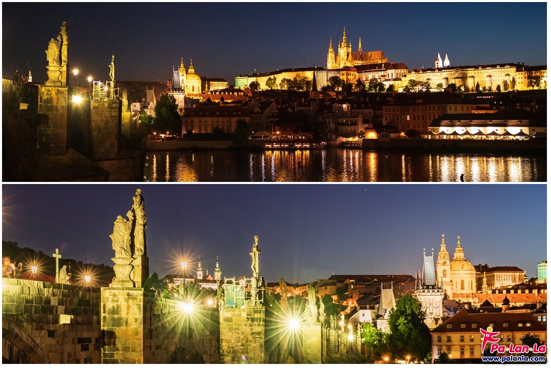
2. Lesser Town Bridge Tower (Left Side)

Lesser Town Bridge Tower (Left Side), although it is not as famous as the Old Town Bridge tower that was built at the other side. However, it is also architectural beauty and it was built with other parts of the bridge, making it is worth to sightsee. Moreover, the left side of the Lezzer Bridge tower is also one of the area for take picture which not only enjoy the view of the Charles Bridge but also take in the view of the St. Nicholas Church, which was built together with the Old Town Bridge tower.
GPS Coordinates : 50°05'13.2"N 14°24'33.8"E
3. Lesser Town Bridge Tower (Right Side)
Lesser Town Bridge Tower (Right Side), If walk to the right side of the tower bridge which you will find that the wonderful view of the Charles Bridge that is worth for taking pictures because you could have pictures of a stones arch that were used to be the base for support weight of the bridge in which reflected from the water surface of the charming Valtava River.
GPS Coordinates : 50°05'11.9"N 14°24'33.6"E
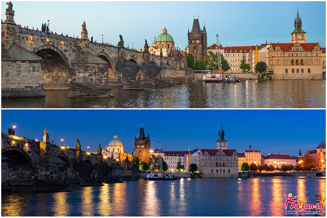
4. Manes Bridge
Manes Bridge, the main thoroughfare for crossing the Vltava River to various parts of Prague but it has more area than Charles Bridge. In addition, it was located at the same plane with the Charles Bridge so when look down from top of the bridge that could get photos of the bridge where you could see almost all Charles Bridge.
GPS Coordinates : 50°05'22.4"N 14°24'45.7"E
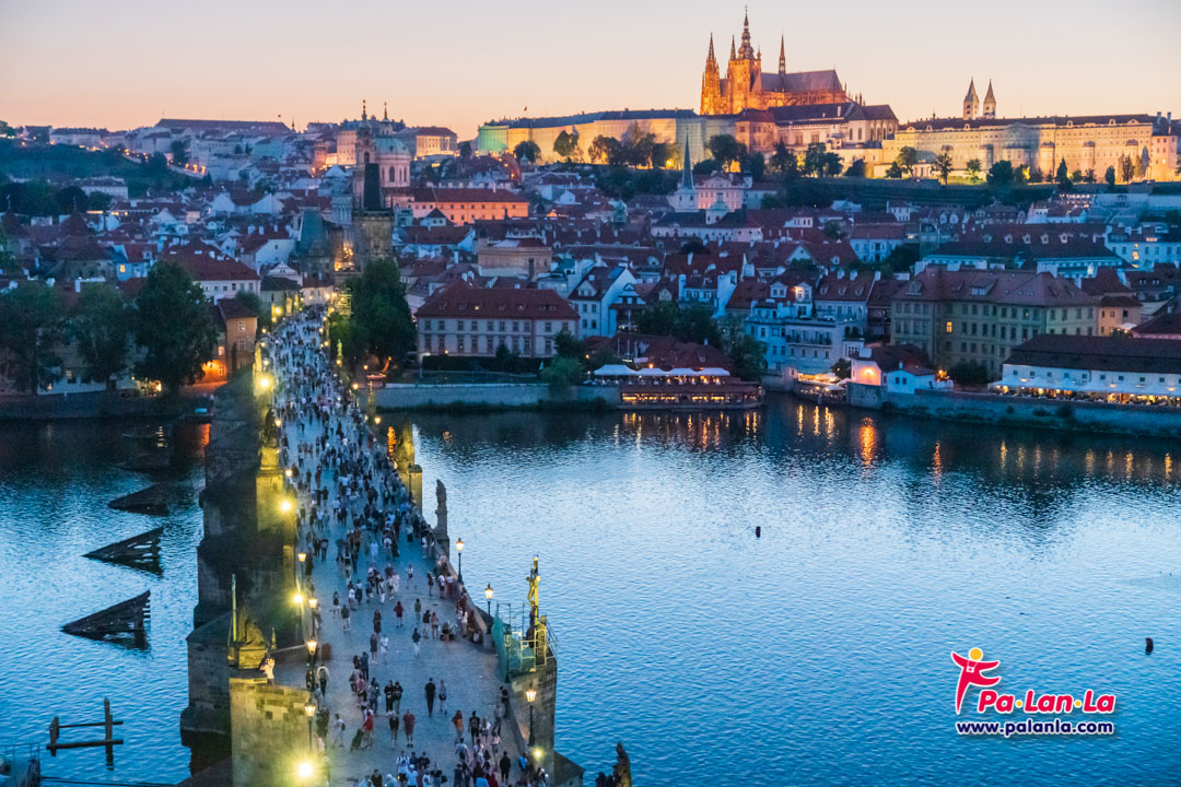
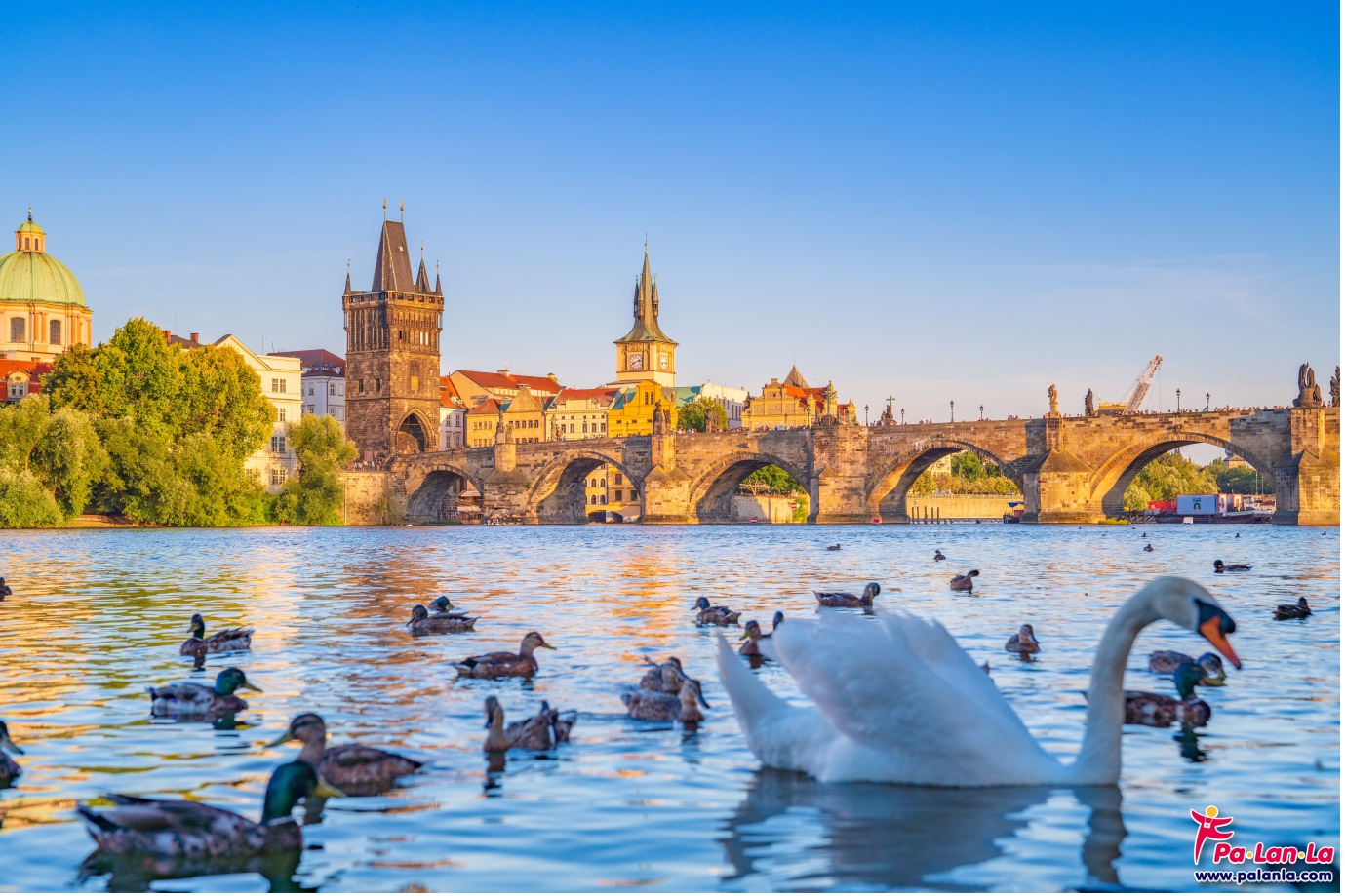
5. Old Town Bridge Tower (Right Side)
Old Town Bridge Tower, is an entrance gate that has been being used to welcome visitors to the old town for hundreds of years. The tower is also a viewpoint of the Charles Bridge. And it was regarded as one of the nice scenery for photograph the Charles Bridge. Because it is the same area with the bridge.
GPS Coordinates : 50°05'10.2"N 14°24'48.9"E
6. Old Town Bridge Tower
Old Town Bridge Tower (Right Side), In addition to the viewpoint on the Old Town Bridge tower that can take pictures of the bridge from a high angle then The side area of the Old Town Bridge tower. Also open for tourists to walk together as well. And if walking to the right of the old city bridge tower Will find that there is a shooting corner where you can see the bridge And the stone arch that is used as the base around to support the weight of the bridge very clearly Because it is a zone that is adjacent to the Valtava River.
GPS Coordinates : 50°05'10.3"N 14°24'48.7"E
7. Petrin Tower
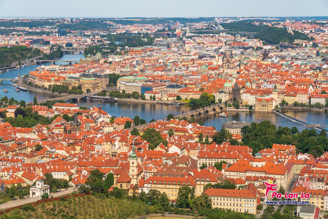
Petrin Tower, a 64-meter tower that was built on the hill of Petrin and 318 meters above sea level. As a result, the Petrin Tower is a high and stunning viewpoint in Prague. Because of the viewpoint, you could see not only the all old town of Prague but also you could see bridge very clearly.
GPS Coordinates : 50°05'00.5"N 14°23'42.4"E
8. Prague Metronome
Prague Metronome, was built on the top area of Prague in terms of geography. As a result, it has been being used to be a skating facility in the city. Moreover, the highest part of the plains could see throughout the Charles Bridge and all of the bridges over the rivers. And there is another space for taking photos of both sides of the Valtava River, causing the perfect composition of picture.
GPS Coordinates : 50°05'41.0"N 14°24'57.0"E
9. Cihelna Park
Cihelna Park, a place has long been used to be an recreational area for people who live in the old town. It is the location of the cruise terminal that tourists can sightsee the view of the old town through the Vltava River by cruise. And if tourists come to stand at the side of the river where is an nice area to take pictures of the Charles Bridge. Because you can see the stones arch which are base to support the weight of the bridge that emerge from the water. Moreover, in the nice time you could see the reflection of the bridge on the water surface.
GPS Coordinates : 50°05'20.4"N 14°24'40.2"E
Useful Information : Weather Forecast https://www.accuweather.com/
National Tourism Organization https://www.prague.eu/
Currency : Koruna Czech (CZK)
Currency Rates https://www.xe.com/currencyconverter/
![]()
Embassy of the Czech Republic in Thailand https://www.mzv.cz/bangkok/en
You May Also Like
Top 4 Must-Visit Cities from Oslo to Alesund, Norway
READ MORE
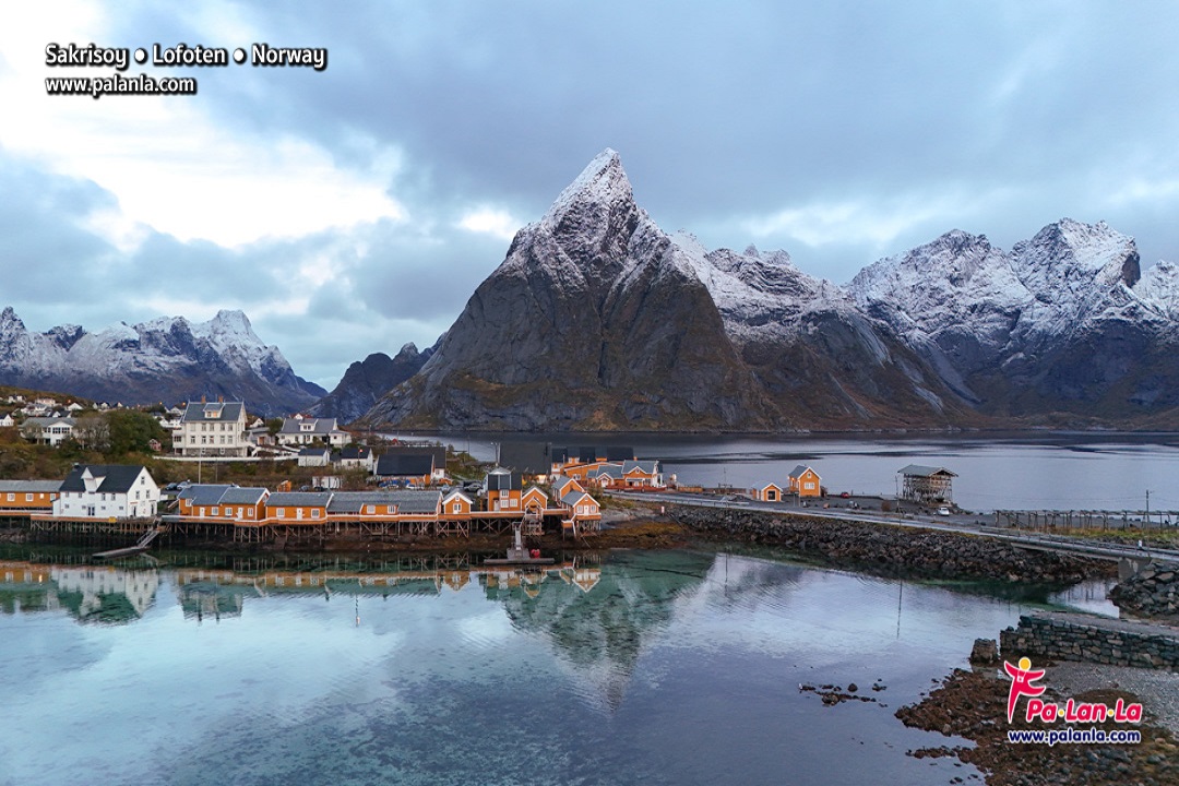
Top 3 Must-Visit Cities from Oslo to Lofoten, Norway
READ MORE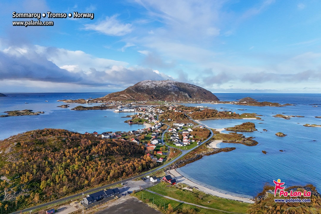
Sommarøy, Tromso, Norway
READ MORE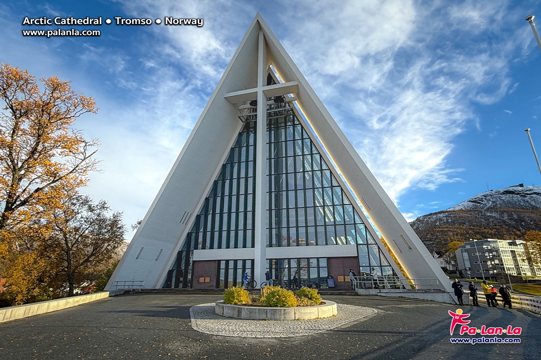
Arctic Cathedral, Tromso, Norway
READ MORE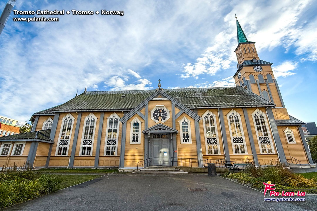
Tromso Cathedral, Tromso, Norway
READ MORE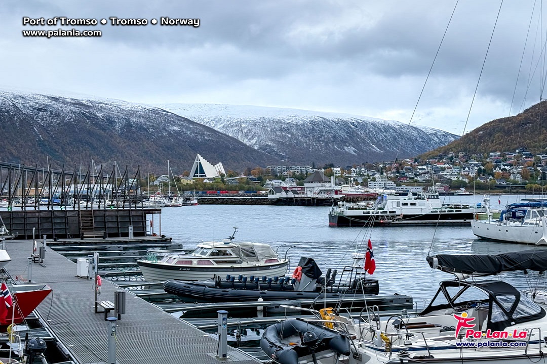
Port of Tromso, Tromso, Norway
READ MORE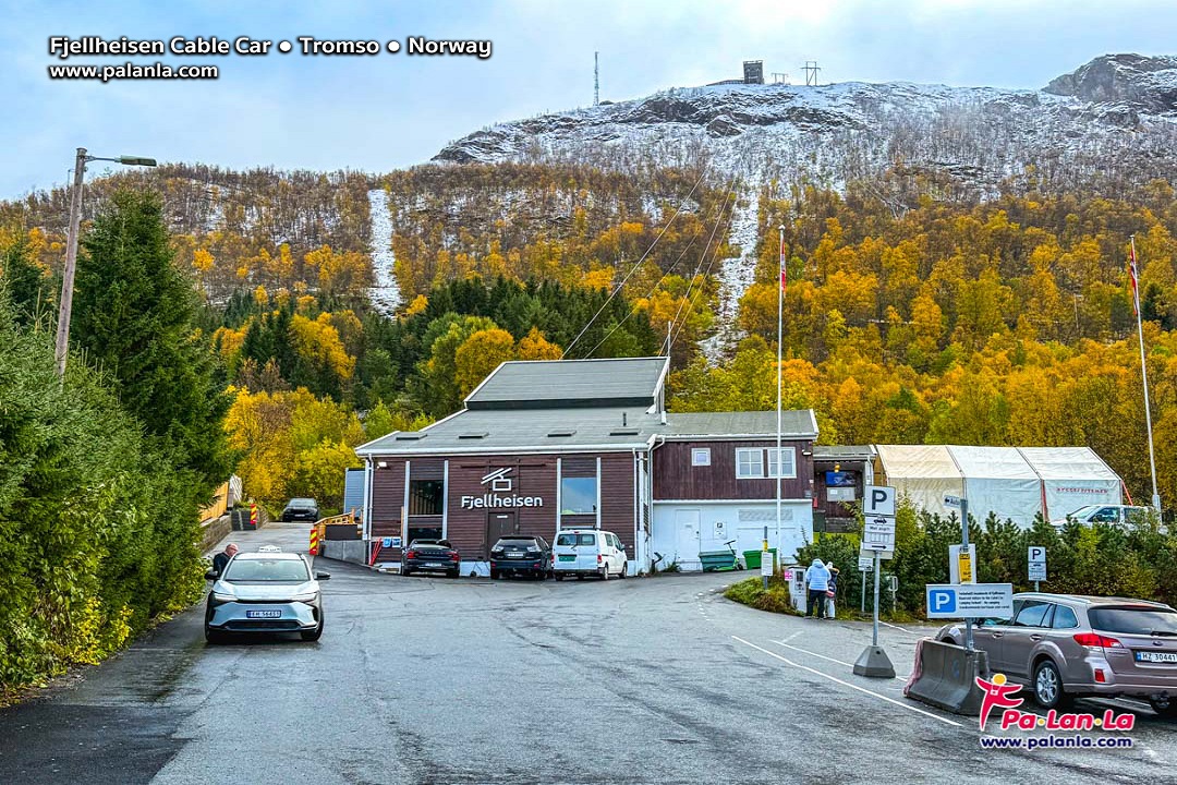
Fjellheisen Cable Car, Tromso, Norway
READ MORE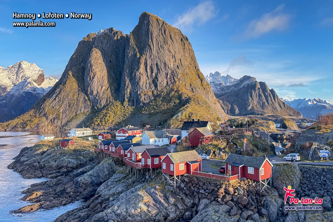
Hamnoy, Lofoten, Norway
READ MORE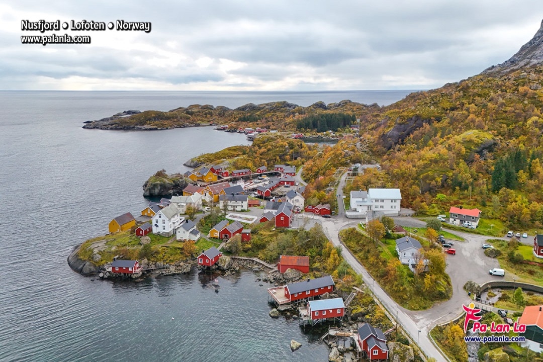
Nusfjord, Lofoten, Norway
READ MORE